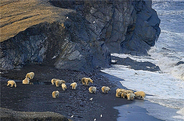
Chukotka Autonomous Okrug is located in the very east of the mainland and Russia. Beringia National Park stands out against the backdrop of numerous local beauties. It covers an area of 1.8 million hectares and is located in several districts.
Islands, lakes and headlands are the highlight of this northern part of the country. Getting to some of them is problematic, but the experience is worth the effort. There are also unique objects, such as abandoned Eskimo settlements or a fur farm where Arctic foxes are raised. For fans of extreme sports, there are multi-day tours with whale hunting. Those who are closer to history will like walks through the museums of Chukotka and its capital - the city of Anadyr.
The most interesting and beautiful places in Chukotka
List, photos with names and descriptions of popular attractions in the region!
Providence Bay
Belongs to the Gulf of the Bering Sea. The length, measured along the middle line, is 34 km, the width is about 8 km. The depth reaches 150 m, which is good for ships. Providence includes several smaller bays. The area was first described during an expedition in 1660, but for another 200 years it remained without a name. In the past, an Eskimo village was located on one of the banks, but by the middle of the last century they left here.

Trinity Cathedral
Cathedral in Anadyr, built on the high bank of the bay. Founded in 2000, consecrated 5 years later. The largest of the wooden Orthodox institutions that exist in permafrost conditions. The height is about 25 m, it can simultaneously accommodate up to a thousand believers. The iconostasis is five-tiered, the icons in it are made in the style of the Greek and Rublev. A bronze monument to Nicholas the Wonderworker is erected next to the cathedral.

Whale alley
Located on Ityngan Island. The length along the coastline is half a kilometer. Discovered in 1976, dates back to the XIV century, although there are assumptions about an earlier occurrence. The alley is a complex of parts of bowhead whale skeletons dug into the ground. The area was used as a sanctuary by the Eskimos, and pits were dug here for storing food.

Wrangel Island
Location - the Arctic Ocean, between two seas: Chukchi and East Siberian. The name was given in honor of the 19th century navigator. The area is 767 thousand hectares. In the past there were settlements, now there are no permanent residents. Used by the military for radar and aviation guidance. The terrain is mountainous, there are many rivers and lakes. It is part of the reserve of the same name and a UNESCO World Heritage Site.

Lake Elgygytgyn
Located in the Anadyr region. Area - 119 km², maximum depth - 174 m. The name translates as "white lake". Most of the year, the surface is covered with ice, sometimes it does not melt even in summer. The shores are shackled by permafrost. Elgygytgyn is a natural monument of Chukotka. In many respects it is guarded because of Svetovidov's long-finned paliti - a fish that is not found anywhere except this lake.

Cape Dezhnev
The extreme point of Eurasia and Russia. The mountain range has a height of over 700 m, a flat top and drops off abruptly into the sea. The extreme point of North America is only 86 km away. The arctic climate is suitable for a number of species. There is a walrus rookery, bird colonies, whales and killer whales appear near the coast. Sightseeing: a monument-lighthouse in honor of the explorer Dezhnev and the archaeological site of Ekven.

Cape Shelagsky
The northernmost in Chukotka. Around the cape the waters of the East Siberian Sea. It was first described by Dezhnev during the 1648 expedition. The current name in honor of one of the local peoples was received much later. In the past, a polar hydrometeorological station operated here, which was liquidated in the 80s of the last century. On the shores of the cape, seabirds organize nesting sites. Tourists observe cormorants and several species of seagulls.

Historical and cultural complex "Masik"
Occupies the southern coast of the Mechigmen Spit. The nearest village is Lorino. In the past, there was a village of sea hunters, but half a century ago they left these lands. People left behind picturesque skeletons of buildings, whale bones, special pits for storing food, and so on. Tourists are brought by sea for 3 months a year. It is almost impossible to get to the complex by land.

Lorin sources
They are located not far from the village of the same name on the banks of the Mechigmenskaya Spit. The temperature in the springs is up to +60 ° C. The water outlet area is relatively small. It is not preserved in its natural form. A well was built at the site of the most powerful outlet, and part of the flow goes through pipes for use in the economic needs of the region. By their composition, the sources are considered useful for the treatment and prevention of diseases.

Pegtymel petroglyphs
Found near Mount Keinynei in 1965. A little later, a specific place of distribution of rock paintings was recorded. The approximate area of distribution is 13 km². A parking lot of ancient people was discovered nearby. There are discrepancies about the time when the archaeological site appeared, but not later than the end of the 1st millennium. The second wave of research is in the 2000s. At the same time they made copies of the petroglyphs.

Port of Anadyr
The largest in the entire region. Built in 1955. Occupies an area of almost 12 hectares. There are 6 sunken ships in its water area. The navigation period lasts from July to October. Moreover, ships are often accompanied by icebreakers. The port is a transshipment base for the subsequent distribution of goods to villages and cities. Many settlements of the Chukotka Autonomous Okrug depend on this transport route for food supplies.

Museum Center "Heritage of Chukotka"
Founded in 2002 in the city of Anadyr. It included the local museum of local lore and the Center for the Protection and Restoration of Historical and Cultural Monuments. The collections cover all the important events of the Chukotka Autonomous Okrug. There are exhibits obtained by archaeologists, dioramas, examples of the life of indigenous peoples, etc. Particular attention is paid to the nature of the region. On the basis of the museum there are programs for children of different ages.

Monument to the Fighters for Freedom
Installed on the banks of the Anadyr estuary in 1980. It is dedicated to the events of the 1920s, when the Bolsheviks were temporarily displaced in Chukotka. Those who died in this case were honored with a monument. One of the heroes - Mikhail Mandrikov - the first Revolutionary Committee of Chukotka with a banner in his hands stands on a dais, and at a distance from it - a group of associates. From here opens a beautiful view of the city port.

Monument to the writer Yuri Rytkheu
The opening took place in Anadyr in 2011 on the birthday of the writer. Although Rytkheu lived most of his life in St. Petersburg, he did not lose touch with his small homeland until the end of his days. Including participated in the literary competition named after him, held since 1998. The basis for the creation of the monument was a photograph of the writer lying on the bank of the estuary with his dogs. The monument is made of bronze.

Monument to Leonid Frantsevich Grinevetsky
Installed in the city of Anadyr in 2014. The square around the bronze monument also bears the name of the founder of the city, Grinevetsky. Leonid Frantsevich is known not only for this, in his biography there are many achievements in medicine, public service, he became famous as a member of the Russian Geographical Society. The figure of the researcher stands on a pedestal where his name is carved, and he is holding binoculars.

Beringian Heritage Museum
It was formed in the village of Providing in 1985. The collection began with 130 paintings donated by Moscow painters. Archaeological and ethnographic finds and materials were added to the works of art. Most of the exposition is devoted to local peoples, their way of life and crafts.Models of national buildings have been established, examples of costumes and household items are given.

Chaunsky Museum of Local Lore
Founded in 1877 in the city of Pevek. Until 1996, it had no independence and was a branch of the Chukotka Museum of Local Lore. The funds contain 4 thousand exhibits. The collection consists of archaeological finds, works of art, documents, rare photographs, national costumes, paraphernalia, weapons of hunters, etc. The museum has a lecture hall and a cinema.

Naukan
Belongs to the territory of Cape Dezhnev. This Eskimo settlement ceased to exist in 1958. At the time of the dissolution in the course of the program of consolidation of local villages, 400 people lived here. The ruins of buildings have been preserved, in addition, breathtaking views open from here. However, getting to Naukan is not easy, you cannot do without an experienced guide. Together with the tract, it is included in the "Beringia" - a natural-ethnic park.

Whalen
The easternmost settlement of Eurasia and Russia. More than 600 people live. Located at the foot of the hill. Related to this is the choice of the name translated as "black earth". Here they are engaged in fishing for fish and sea animals. The infrastructure for such a small education is well developed. Attractions nearby: Naukan - an abandoned Eskimo settlement, Ekven and Uelensky burial grounds.

Pevek port
The northernmost in Russia. Founded in 1951 and occupies about 19 hectares. It is part of the Northern Sea Route. Navigation time is from the beginning of July to the end of October. There are certain size and draft restrictions for ships to enter the port. In 2016, the reconstruction of some berths began. A year later, they began to expand the area of the port due to the demolition of nearby houses.

Anyui volcano
Located in the Bilibino region. The crater has a diameter of 300 m and a depth of 65 m. Its lava flows in the past helped to form the mountain system. Belongs to Mount Vulcan, whose height is about 1.5 thousand meters. It is believed that the last eruption of this stratovolcano occurred in the 18th century. It has been a natural monument together with its surroundings since 1983.

Lake Tytyl
Belongs to the territory of the Bilibino region. The name is translated from the Chukchi language as "door" or "entrance". The area is 40.5 km². The Tytylvaam River flows through the lake. Freezes in early October, ice lasts until mid-summer. The surroundings are protected from the negative impact of people on the environment. Numerous excavations have revealed about 50 hunter sites, some of them 10 thousand years old.

Ratmanov Island
It is located in the Bering Strait and is the most eastern point of Russia. It received its name in honor of the navigator. The area is almost 3 thousand hectares. The first expedition to record a visit to the island dates back to 1655. One of the largest bird colonies in the region is located here. The island became a base for border guards. In addition to the frontier post, there is a meteorological station and numerous outbuildings.

Fur farm in Lorino
One of the two surviving nurseries in Chukotka, the other in Inchoun. At the same time, about 400 adults and one and a half thousand puppies are kept here. The cages with Arctic foxes are partly wooden and stand on stilts. The animals are fed with minced meat and bones of sea inhabitants. It is necessary to arrange an excursion in advance, since quarantine has been introduced here so that the population does not become infected with anything from uninvited guests.

Whaling
Such tours are provided by many local excursion companies. They often start from Lorino. The program includes not only the presence on the hunt, but also visits to some of the sights. Tours are multi-day, their cost includes accommodation, transport, as well as other services by agreement with a specific operator. The hunt itself is watching the pros, chasing a whale, butchering prey.


